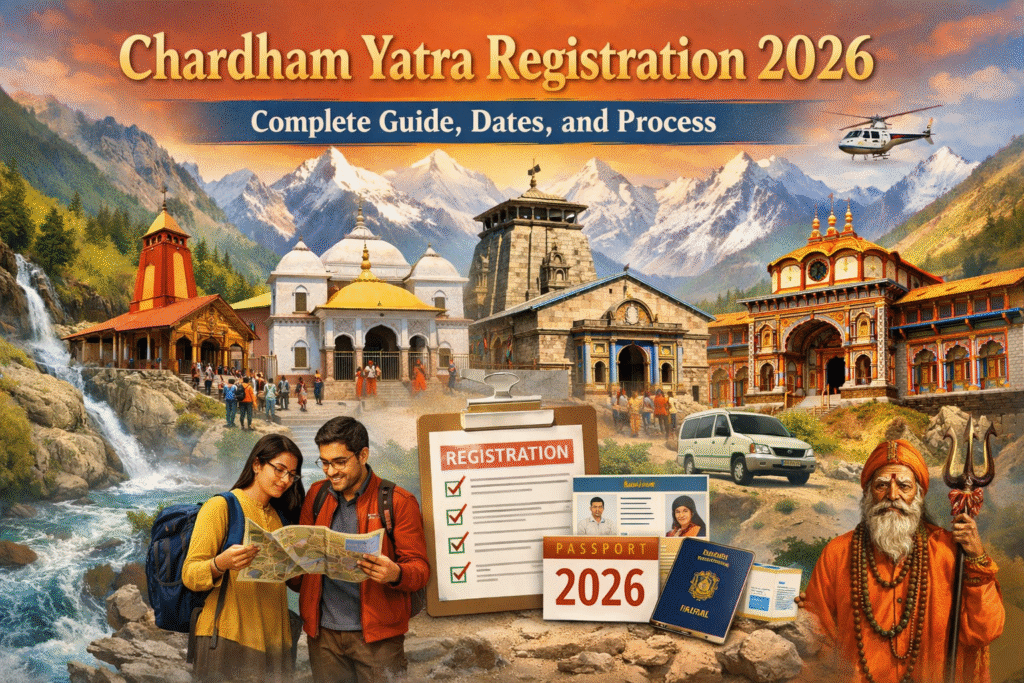
The Char Dham Yatra is one of the most revered pilgrimages in India, drawing thousands of devotees each year to the holy Himalayan towns of Uttarakhand. Covering Yamunotri, Gangotri, Kedarnath, and Badrinath, this spiritual journey is as much about devotion as it is about breathtaking natural beauty. Understanding the Char Dham route from Yamunotri to Badrinath, along with planning logistics, distances, and road conditions, is essential for a smooth and memorable yatra. A well-prepared Char Dham Yatra map can be your ultimate guide for this sacred expedition.
The Char Dham Yatra Sequence
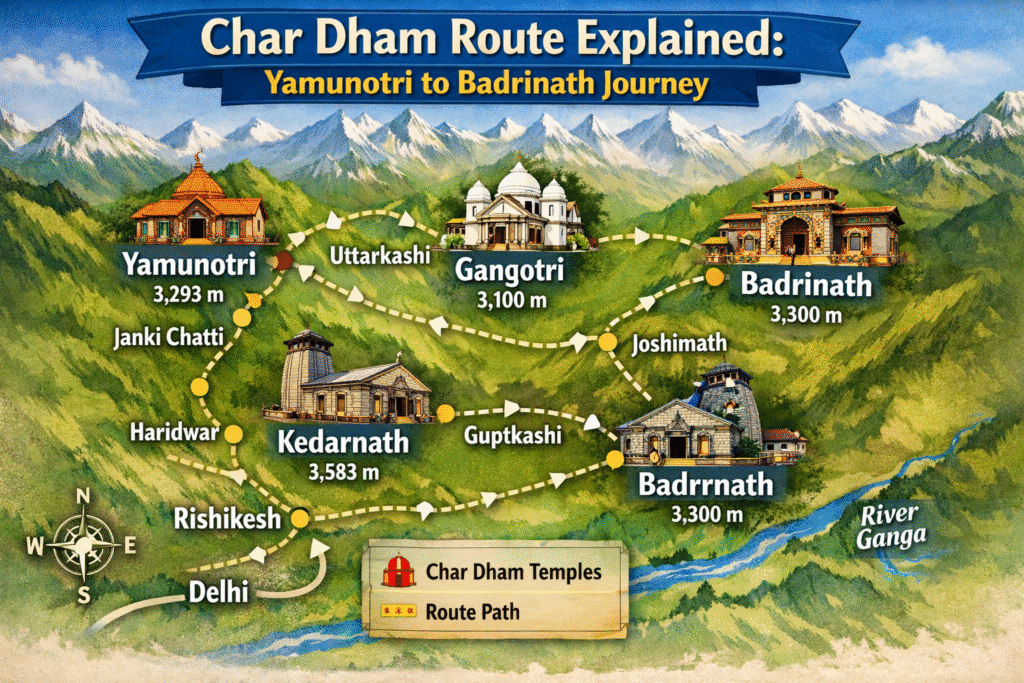
The traditional Char Dham Yatra sequence begins with Yamunotri, followed by Gangotri, Kedarnath, and finally Badrinath. Starting from Yamunotri, pilgrims gradually make their way to the other dhams, immersing themselves in both spiritual and natural experiences along the way. The journey is designed to honor the legends of the Hindu faith, visiting sacred rivers, ancient temples, and Himalayan landscapes that have inspired devotion for centuries.
A detailed Char Dham Yatra map helps pilgrims visualize this sequence, identify the distances between destinations, and plan the necessary rest stops. It ensures that travelers can manage their time efficiently while enjoying the scenic beauty of Uttarakhand.
Yamunotri
The Sacred Source of Yamuna
The journey begins at Yamunotri, located at an elevation of 3,293 meters in the Garhwal Himalayas. This is the source of the sacred Yamuna River. Pilgrims often trek about 6 km from Janki Chatti or 13 km from Hanuman Chatti to reach the Yamunotri Temple. Hot water springs and the serene environment make this first leg of the Char Dham Yatra route truly memorable.
When planning your visit, a Char Dham Yatra map with distance can help you gauge trekking times and ensure you carry necessary essentials such as warm clothing, trekking shoes, and light snacks.
Gangotri
The Birthplace of the Ganga
From Yamunotri, the yatra proceeds to Gangotri, the source of the sacred Ganga River. Situated at an altitude of 3,415 meters, Gangotri is surrounded by snow-clad peaks, offering a serene and spiritual setting. The trek from the nearest parking point to the temple is short, usually around 1 km, making it accessible for most pilgrims.
The Char Dham Yatra by road takes you through picturesque valleys, rivers, and forests. Using a Char Dham Uttarakhand map can help you navigate these winding roads safely and plan your overnight halts in towns like Uttarkashi.
Kedarnath
The Abode of Lord Shiva
Next on the Char Dham route Uttarakhand is Kedarnath, one of the twelve Jyotirlingas of Lord Shiva. Kedarnath is located at an altitude of 3,583 meters and is accessible by a 16 km trek from Gaurikund. The temple, set against the backdrop of snow-capped peaks, is a spiritual haven.
For this leg, pilgrims can consult a Char Dham Yatra route map with distance to plan their journey effectively. Road travel takes you to Gaurikund, after which the trek begins. The yatra route here is more challenging, but the divine ambiance makes it a life-changing experience.
Badrinath
The Final Destination
The final destination of the yatra is Badrinath, dedicated to Lord Vishnu. Located at an altitude of 3,133 meters, Badrinath is part of the Garhwal Himalayas and is surrounded by the Neelkanth peak. The Badrinath Temple attracts thousands of devotees, particularly during the summer months when the Char Dham Yatra is in full swing.
A well-laid Char Dham Yatra map will show the Char Dham Yatra distance between Kedarnath and Badrinath, along with alternate routes and stops in towns like Joshimath, making your planning efficient and stress-free.
Planning Your Char Dham Yatra by Road
Traveling the Char Dham Yatra route by road has become increasingly popular due to improved connectivity and scenic drives. Roads are well-maintained from major towns such as Rishikesh, Dehradun, and Haridwar to the Char Dham locations. For instance, from Rishikesh, Yamunotri is around 230 km, Gangotri 250 km, Kedarnath 230 km, and Badrinath 310 km by road.
Using a Char Dham Yatra map or Char Dham road map route helps travelers track distances, identify fuel stations, restaurants, and emergency stops. It also ensures you can enjoy the journey without worrying about navigation challenges.
For a hassle-free experience, services like DestinationTourCabs offer reliable taxi options for the entire yatra. They provide comfortable vehicles, experienced drivers, and customized itineraries to cover all dhams efficiently. Book your ride with them and experience a seamless pilgrimage.
Important Tips for the Char Dham Yatra
- Best Time to Visit: May to June and September to October are ideal, avoiding heavy monsoon and winter snow.
- Travel Light: Carry only essential items including warm clothing, trekking shoes, and personal medication.
- Stay Hydrated: Altitudes can cause dehydration and fatigue, so keep water handy.
- Acclimatize: Spend a day in Uttarkashi or Joshimath before heading to higher altitudes like Kedarnath and Badrinath.
- Consult Maps: A Char Dham map provides real-time updates on road conditions, routes, and weather advisories.
Using a Char Dham Yatra Map Effectively
A Char Dham Yatra map is more than just a navigation tool. It allows pilgrims to:
- Visualize the Char Dham on map and understand the terrain.
- Identify Char Dham Yatra route map with distance between each dham.
- Plan overnight halts and refreshment stops.
- Track alternate routes in case of landslides or roadblocks.
Maps are especially helpful for families, senior citizens, and first-time travelers who want a safe and comfortable yatra experience.
Conclusion
The Char Dham Yatra from Yamunotri to Badrinath is not just a spiritual journey but also a chance to witness the natural grandeur of Uttarakhand. With careful planning, an accurate Char Dham Yatra map, and reliable transport, devotees can experience a smooth, memorable pilgrimage.
For those seeking convenience and comfort, consider booking your journey with DestinationTourCabs. Their expert drivers and well-maintained vehicles ensure that your Char Dham adventure is seamless from start to finish. Begin your spiritual journey today and let the mountains guide your soul.
FAQs
How long does it take to complete the Char Dham Yatra by road?
Generally, it takes 10-12 days to cover all four dhams comfortably, depending on rest stops and trekking pace.
Is it necessary to trek to all the temples?
Some temples, like Kedarnath and Yamunotri, require short treks, but alternatives like pony rides or helicopters are available.
Can I use a Char Dham Yatra map on mobile for navigation?
Yes. Digital maps or downloadable Char Dham Yatra maps are perfect for real-time guidance and distance tracking.
Which is the toughest leg of the Char Dham Yatra?
The Kedarnath trek is considered the most challenging due to steep paths and high altitude, so plan acclimatization accordingly.
Are there accommodation options along the Char Dham route?
Yes. Towns like Uttarkashi, Gaurikund, and Joshimath offer hotels, guest houses, and dharamshalas for every budget.
Can I hire taxis for the entire Char Dham Yatra?
Absolutely. Services like DestinationTourCabs provide comfortable vehicles and experienced drivers to cover all dhams efficiently.